Stretch Of Highway Unlikely To Offer Clues Into Fatal Crash
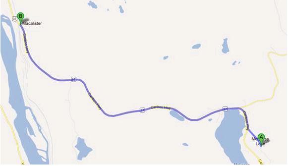
Accident data for 2006-2010 for Hwy 97 between Macalister and McLeese Lake map courtesy ICBC
Prince George, B.C. – The stretch of Highway 97 that includes the site of last week’s fatal collision that claimed the lives of five Prince George residents, including two children, is not considered a high crash area…
RCMP have said it may be impossible to determine the exact cause of last Thursday morning’s head-on collision due to the extent of vehicle damage sustained during the ensuing fire, and it does not appear that particular section of the route will offer up any additional clues.
According to data provided by the Insurance Corporation of British Columbia, in the five years between 2006 and 2010 there have been a total of 17 crashes resulting in injuries or fatalities on Highway 97 between McLeese Lake and Macalister.
The following table shows the number of casualty crashes (crashes involving injury or fatality) in the approximate 10-kilometre stretch between the two communities:
| Year | Total # of Casualty Crashes |
| 2006 | 7 |
| 2007 | 2 |
| 2008 | 4 |
| 2009 | 3 |
| 2010 | 1 |
To put the data into perspective, ICBC spokesperson, Kathy Taylor, says police attended 3,100 crashes in the North Central region in 2009, so the 3 incidents along this stretch represent just 0.10-percent of all accidents that year. While data is not immediately available for 2010, Taylor estimates the percentage is likely even lower, given there was just one casualty crash that year.
Comments
Although it is unproven and the cause of this terrible accident may never be found my personal experience would suggest that cruise control and a little ice maybe the cause. With the weather conditions we have had lately isolated icy road conditions are not uncommon. Slight chance in elevation, shadow area, temperature inversions, can all be causes for a road surface to become icy. Might be for miles might only be for a few hundred feet. This is why in our Northern Winter Climate one should always drive with extra caution and never take road conditions as ever being 100% safe. It only takes that one spot. Many people do not realize that if your cruise control is on and you loose traction (ice, heavy rain)the cruise control will accelerate the vehicle to try and compensate for the loose of speed like when going up a hill. This sudden acceleration on slippery road conditions can cause a vehicle to go out of control very quickly, and in the time delay it takes to deactivate the cruise your vehicle is already spinning uncontrollably.
My understanding is that many of the newer vehicles have an anti slip system now as part of their safety system to help prevent this however I believe nothing is ever as safe as have complete control over the accelerator.
Lose!
but most people know “Hotwire” that as soon as you hit the brake the cruise control is disengaged.
and: loss!
metalman.
By the time you hit the brake it is likely too late, depending on the speed you are travelling. Not only that, but it is highly likely to make matters worse.
When hitting a non-traction or low-traction patch, the first thing one should be doing is feet off the accelerator AND the brake and try to steer the car to the nearest area that looks like it has better traction. When steering do it slowly.
———————————–
“I believe nothing is ever as safe as have complete control over the accelerator.”
I agree, but not only the accelerator, the brake as well.
“it does not appear that particular section of the route will offer up any additional clues”
It almost sounds like there is little if any evidence on the road to indicate where the vehicle started to move across the lanes and crashed into the truck. I would assume with the mass-inertia of the truck, that the SUV was carried some distance northward and that the impact location was to the south of the final location of the vehicles we see in the picture. In fact, the yellow markers on the road for photo location are towards the south.
Comments for this article are closed.