Severe Thunderstorm Watch On
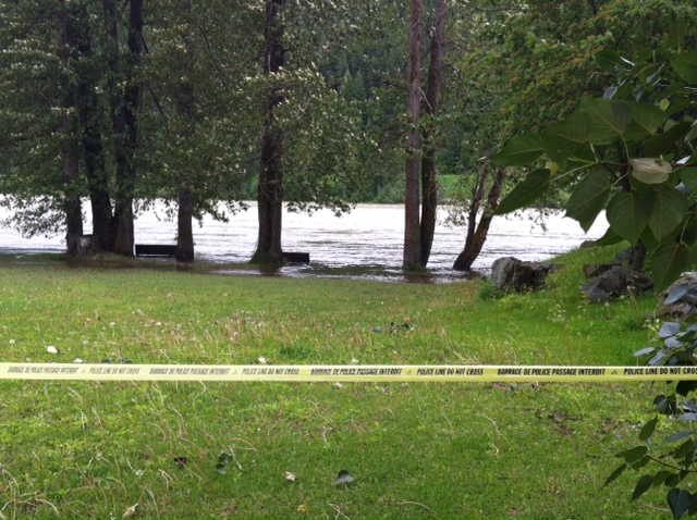
Riverside benches in Paddlewheel park once again bathing in water
Prince George, BC – Environment Canada has issued a severe thunderstorm watch for the Prince George region, but has ended a rainfall warning.
A moist Pacific weather system is moving over Central BC and is now forecast to drop between 10 and 20mm of rain, down from the 25-50mm earlier predicted.
However, the weather agency says a few thunderstorms are forecast to develop this afternoon and the potential exists for isolated severe storms, producing large hail, rain, and strong wind gusts.
The BC River Forecast Centre issued a High Streamflow Advisory on Thursday in anticipation of this weekend’s rain. So far, the advisory has not been upgraded to a flood watch. The Centre expected area river levels to peak tomorrow or Monday.
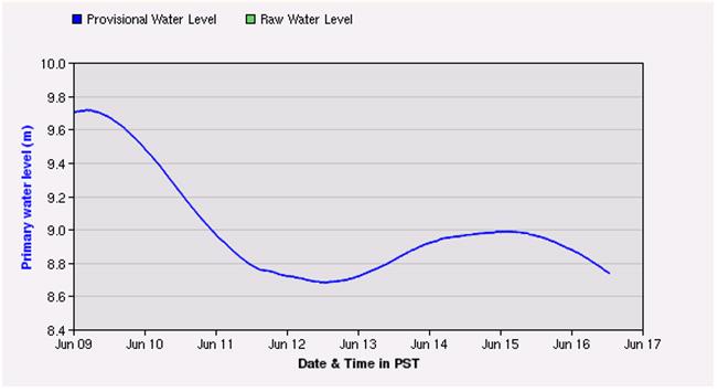
The graph below shows the Water Survey of Canada’s real-time hydrometric data, which monitors water level and streamflow, at South Fort George, where the river level peaked last night, and was at 8.71-metres as of 12:40pm this afternoon:
Comments
Summertime in the Pig.
I love thunder storms….
Crappiest June I can recollect. Global warming going around us?
Harbinger: you don’t remember last year then.
Global warming refers to the total world temperature. Each part of of the world is affected differently by it. The prediction some years ago was that our part of the world will end up with typically:
1. warmer winters
2. cooler summers
3. higher precipitation.
So far, since about 1999, the prediction is relatively accurate to what I can remember of weather for the 25 years before that since I moved here.
Comments for this article are closed.