States of Local Emergency Reinstated
Monday, June 18, 2012 @ 1:28 PM
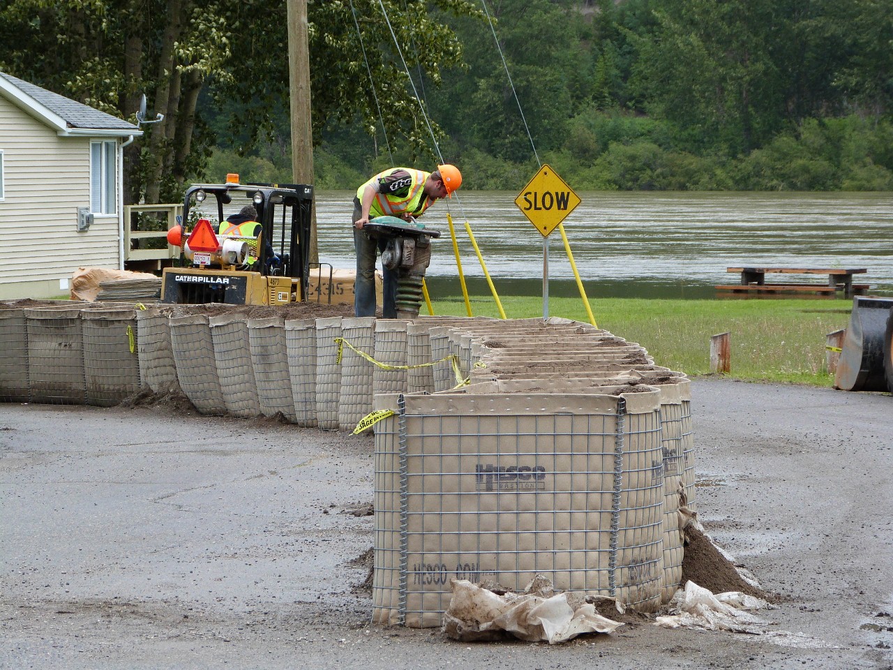
Sand is packed down in existing gabion dike to prepare for second layer of diking to be installed on top.
Prince George, B.C.- The State of Local Emergency has been reinstated in four areas of Prince George.
In addition, evacuation orders have been issued to 17 residences on Farrell Street and 1 residence on Regent Street. Paddlewheel Park remains closed. Additional evacuation alert notices will be issued to some residences on Weins Road and Houston Lane. The Nechako River also continues to rise, and States of Local emergency have been declared along PG Pulp Mill Road, and in the area between First Avenue and the banks of the Nechako.
The Regional District has issued evacuation alerts to residents in Foreman Flats and residents along the Fraser River bank in Shelley. There are 22 homes in Foreman Flats that are included in the evacuation alert area, and 11 homes in the Shelley area that are included. Residents in those areas are advised to contact the Regional District of Fraser-Fort George at 1-800-667-1959 in the event that their home is threatened by flooding.
Work has started to augment the gabion dikes on Farrell Street as the Fraser River is predicted to peak tomorrow at a height of 10.8 meters, the highest it has been in 40 years. ( Previous high mark was in 1972 when it reached 10.442 meters)
The Prince George City Hall has been designated as the reception area for those who have been ordered from their homes.
All City of Prince George residents in the affected flood areas are asked to register by calling 250-561-7600. If required, residents are eligible for short term emergency assistance of food and shelter. These services are coordinated through the Evacuation Support Program and require in-person registration at the City Hall Annex. The reception centre is open until 8 pm tonight and open again at 8:30am Tuesday June 19, 2012.
The B.C. River Forecast Centre is predicting that elevated river levels on both the Fraser and Nechako will continue for the next several days.
Maps below outline areas under States of Local Emergency:
.jpg)
.jpg)
.jpg)
.jpg)
.jpg)
Comments
Looks like the city wasn’t “SO STUPID” after all.
Thanks Prince George Citizen for your idiotic headline!
I was under the impression the dyke was going to be along the Nechako ,not the Fraser. In either case it would not help residents on the North side of the Nechako. Am I wrong ,pardon me if I am.
The house pictured between the dike and the river expendable?
Yes..it is. I’m tired of paying to look after it every time the Fraser goes up. Time to get tehm out of there forever.
The North Fraser FSR was under water at 17km yesterday.
Just heard from a city worker flood levels may reach the 200 yr level. Word is, city hall may go for a swim too.
http://www.chilliwack.com/main/page.cfm?id=346
That is a link to the Chilliwack Fraser River Flood Protection page. It provides a link to the South Fort George reading as well as others down river from there.
If you click on the “protection webpage” it will alos go into an explanation of the state of the union in realtion to the dikes in place and how they would stand up to an 1894 record year flood event.
I think it is an excellent page and we could use something as inforamtive, easily understood as that for the City of Prince George.
It speaks about height of dykes needing to be increased as a result of new predictions and that they need to be improved from the point of seepage. I think all those are also apply to Prince George.
Please, we have to remember that the dike which was scheduled to be put in place on River Road was only one of many. Most of the other locattions were also in line for protection in the next few years. The sequence can be seen in the report prepared by the consultants.
Of course, we know that many of those posting on here have a dredge, dredge, dredge mindset.
The sequence in the report prepared by the consultants listed the prioritys. Doing nothing was one of the priorities, and of course the dyke on the North West side of River Road between River Road and the River, was Priority Number One, with the others following.
The amount of money to be spent on all the recommendations was immense, and I dont recall anything in the report, or anything from the City that would indicate that they would ever do this work.
Its somewhat interesting to see that the Number One priority ie; West End of River Road between the boat launch and Brink Forest Products, has the least amount of flooding, and seepage to date.
All the seepage is on the South East portion of River Road, basically South of the Boat Launch, and of course the East end of 3rd and 4th Avenues. Then of course we now have seepage at the Spruce Capital Trailer Court, and West of the Ball Fields on Pulp Mill Road.
So. Why was the recommendation made that the West End of River Road from the Boat launch be the 1st priority, and get the sheet piling etc;??? Beats me.
Seems to me those in the most danger at this point in time are in South Fort George, North of the Pulp Mill Road, and the Landsdowne area.
Hmmmmmmmmmmm.
“Doing nothing was one of the priorities”
I suspect doing nothing would not be a priority. It would be an option.
Comments for this article are closed.