UNBC Paper Studies Effects of Mt. Polley Breach
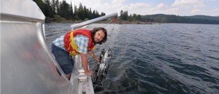
Montreal, QC – A team of UNBC scientists has released a new research paper documenting the effects of last summer’s Mt. Polley Mine breach on Quesnel Lake.
The paper examined the physical and chemical characteristics of the spill, along with the extent of the sediment plume in Quesnel Lake, over a two month period starting with the breach August 4, 2014.
The research team discussed the results at a conference in Montreal this morning.
Lead author Ellen Petticrew said the breach, which discharged 25 million cubic metres of contaminated water and mining waste into the surrounding creeks and rivers, had the following effects on Quesnel Lake:
-Quesnel Lake rose about 7.7 cm due to the input of the material
-Researchers observed a 1-2.5 degree Celsius increase in temperature in the bottom waters of the lake
– The turbidity increased in the West Arm, which is where the material was deposited in the west basin, indicating the existence of a sediment plume at depths below 30 metres
-Copper concentrations in sediment samples collected from Quesnel Lake and Quesnel River are elevated, often above sediment quality guidelines for freshwater ecosystems
-Ultra-fine sediments remained suspended (394 cubic metres representing a surface area of about 1,000 square km)
Petticrew said it would take some time to determine what the long-term environmental impacts of the spill might be.
“We know that the salmon cycle, the four year salmon cycle of the sockeye in the system, are going to be critical to observe over this next little while,” she said. “The salmon were returning to the lake in August, they were on their way up the Fraser River into the Quesnel system when the breach occurred and the flush of material came into the lake.”
Petticrew said those salmon “seem to have spawned very successfully,” but notes they “are concerned about the juveniles from the year before who were in the lake and moving in and out of the (sediment) plume.”
She admitted the research team is concerned “how this affects the biology and our question really is, how resilient is Quesnel Lake to handle this kind of material?”


Comments
I didn’t know we had data on the lake temperatures this time last year. Anecdotal maybe on their part. As is the rise of 7.7 cm – all lakes go up in the spring and down in the summer/fall, on Cluculz this can be a foot difference. I do know they have to quantify their research but there is no way to quantify the level rise and lake temperature without a history of these readings prior to the spill, maybe they do have that info on hand just not releasing the real numbers to reporters. Not that they haven’t done their homework but it sounds like they are taking a chapter out of the climate science workbook.
Surface area of 1,000 square km – so 394 cubic meters means 1 meter thick and 394 square meters in size. So 1,000 sq km is 1,000,000,000 sq meters divide by 394 = 1/2,538,071 of a meter deep or (4e07) .0000004 meters thick or .0004 mm. So if the particle size is .0004 mm you could spread it 1 particle thick over 1,000 square km. What does this mean? Not sure. But then again not sure what the turbidity (how much material suspended in water decreases the passage of light) indicating a sediment plume in one point and then a measured size of a sediment plume in another – seems the two are one and the same point are they not?
Have to read the paper I would guess, see if it is released online…
“sounds like they are taking a chapter out of the climate science workbook”.
You took the words right off my keyboard, no real problem found in the initial investigation but will keep researching milking research money to the last drop. That is taxpayers money.
Comments for this article are closed.