


Blizzard Warning in Effect
By 250 News
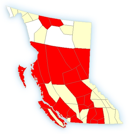
Red areas indicate warnings for wind, blizzard, heavy snow. Map courtesy Environment Canada
Prince George, B.C.- As the map indicates, there are warnings throughout the Province as a strong new weather system moves into the region. For areas on the coast, there is a wind warning, but as you move inland, there are snowfall wind and blizzard warnings.
Strong southerly winds will develop near noon and combine with heavy snow to produce localized blizzard conditions over the Prince George regions. This is a warning that blizzard conditions with near-zero visibilities are expected.
A strong moisture laden pacific frontal system will spread heavy snow into the British Columbia interior today. Snow will develop in the central and northern interior this morning. The snow will gradually make its way into the southern interior and western kootenays this afternoon. Amounts of 10 to 20 cm are forecast by Monday morning. Along with the snow, strong southerly winds gusting to 90 km/h will develop through many central interior regions near noon producing localized blizzard conditions. The blizzard conditions are expected to persist into this evening.
Meanwhile in the southern interior, strong winds of 60 km/h gusting 90 km/h are forecast to develop in the Penticton and Kamloops regions this afternoon. The strong winds combined with falling snow will generate blowing snow through the regions.
Frigid temperatures near minus 30 combined with brisk winds up to 20 km/h are giving extreme wind chill values near minus 40 this morning over the northern sections of the Peace River region. These extreme wind chill values should ease this afternoon as temperatures rise.
Previous Story - Next Story
Return to Home
Good news is Spring is closer today than it was yesterday.