


Much of Province Bracing for Storm
By 250 News
Tuesday, November 16, 2010 03:17 PM
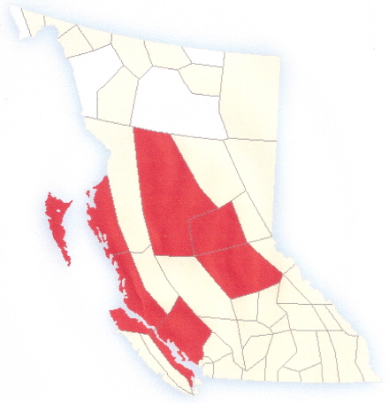
Red areas are subject of weather warning
Prince George, B.C. – Numerous areas in B.C. are on a storm warning from Environment Canada. For Prince George, there is heavy snow and blowing snow with reduced visibility expected on Wednesday.
An intense low pressure system will move towards the central coast on Wednesday. The associated front is forecast to bring snow to the Prince George..Bulkley Valley and The Lakes - southeast including Burns Lake region with snowfall amounts exceeding 10 cm during the day.
An intense low pressure system will move towards the central coast on Wednesday. The associated front is forecast to bring snow to the Prince George..Bulkley Valley and The Lakes - southeast including Burns Lake region with snowfall amounts exceeding 10 cm during the day.
The Arctic front will remain south of Prince George so the combination of strong northeast winds 60 gusting to 80 km/h and the new snow will create poor visibilities in blowing snow.
Meanwhile Cariboo - north including Quesnel is also expected to receive more than 10 cm of snow on Wednesday but blowing snow will not be as much of a factor.
On the North Coast, Environment Canada Meteorologist Lisa Coldwell says an intense low pressure system is heading toward the coast threatening wind gusts of between 80 and 100 km per hour for Haida Gwaii, Prince Rupert, and Bella Bella.
On the North Coast, Environment Canada Meteorologist Lisa Coldwell says an intense low pressure system is heading toward the coast threatening wind gusts of between 80 and 100 km per hour for Haida Gwaii, Prince Rupert, and Bella Bella.
The low pressure system will also bring with it plenty of precipitation, which will turn to snow as it heads toward the interior portion of the province. The system will draw in frigid arctic air leaving up to 10 cm of snow in communities like Burns Lake.
Environment Canada has issued wind warnings for Prince Rupert, Bella Bella, Masset, and Sandspit.
Previous Story - Next Story
Return to Home