


Weekend Weather Nasty For Most of The Province
By 250 News
Monday, December 03, 2007 04:00 AM
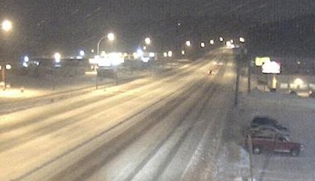
Photo shows Highway 16 west approaching Peden Hill around 8:30 last night (photo courtesy DriveBC)
It was the same story the province over on Sunday night as snow fell throughout B.C.
In the lower mainland one reader phoned to say that he had seen 27 cars in the ditch in various areas along the Trans Canada heading into Vancouver. He also mentioned there were nine semis in the ditch.
In the Central interior the wind ,combined with the snow made driving difficult. The CIty of Prince George crews were out in full force trying to open up all of the main roads in the city Sunday night. But there were plenty of reports of cars hitting the ditch in the area south of Quesnel.
North of the Pine Pass, light winds and roads are in, as one reader says, pretty good shape.
To the west at Terrace, while they have outflow winds which have been very cold, they do not have any snow and the roads are described as very good in and around Terrace. As one trucker put it, "The problem along highway 16 west is getting to Terrace."
Several flights to Prince George were delayed or cancelled on Sunday.
In the Prince George area today the forecast is calling for chilling winds, more snow ( 10-15 cm) and a "high " of -16. Combine that with the wind, and the windchill factor is -33. That means exposed skin can freeze quickly.
There is a snowfall warning and windchill warning in effect for the north and south Peace regions.
The snow is expected to turn to rain in the southern interior and the lower mainland making for an interesting drive to work this morning.
Previous Story - Next Story
Return to Home