


Flood Focus Changes As Ice Jam Moves West
By 250 News
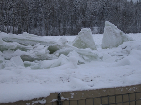
The top of gabion dikes visible at Delhaven as ice piles up on the other side of the dike
Prince George, B.C. - While the ice jam on the Nechako River may have grown in length it has now moved into an area of the city where the jam will have little immediate effect on nearby properties.
The one remaining area of concern in the city would be on Morning Place, where in 1996 an ice jam formed just to the east of t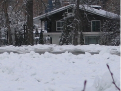 hat subdivision spilling water over the banks.
This year, because the jam had formed near the confluence of the Fraser, the bulk of the damage has occurred in that area.
(at right, photo of a home on PulpMill Road, the drop in water level is evident by the ridge of ice)
What has happened in recent days is that as the ice jam has moved further west up the Nechako River, the area near the Fraser has been carved out by the water, creating a channel, or the ice itself has collapsed with no water present to hold it up and the result has been that the actual level of the Nechako River near where homes were flooded on Pulp Mill Road has dropped by as much as 2 meters.
The side channel ( see photo at left) that was carrying a large amount of water around the jam (during the peak of flooding) 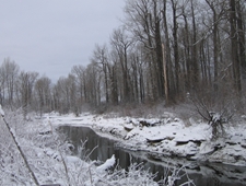 through Cottonwood Island Park near the boat launch on River Road has now been reduced to just a trickle as the Nechako finds its path in the old stream bed and the ice level drops.
In the area of Winton Global, Brink Forest products, and other nearby businesses, the water level is now in most areas about 2 meters below where it stood at the height of the flood.
City Information Officer Don Schaffer says the jam is no threat to the water intake at Fish Trap Island so the only growing concern is for the group of homes on the south side of Morning Place and one home on the west end of North Nechako Road..
Previous Story - Next Story
Return to Home
