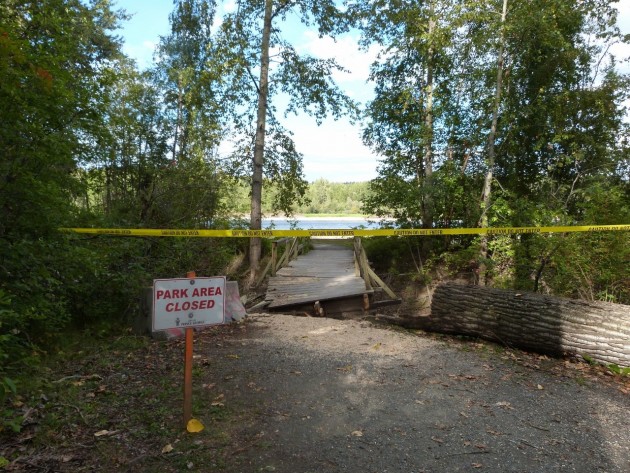
Condition Assessment of Cottonwood Island Park Complete
Prince George, B.C. – The City of Prince George has completed a condition assessment of Cottonwood Island Park.
Sean LeBrun, manager of parks and solid waste services, says it includes a complete asset inventory of everything in the area.
“So everything from outhouses to tables to culverts to little containers. Anything that is an asset of the city we now have mapped.”
Lebrun says the next step is coming up with a “wish list” of things they’d like to see done.
“Whether it’s bridges or reconnecting trails, trying to bring the island back if you will to the pre-ice jam days where we had three or four bridges on the island and the connectivity was much better than it is now.”
He says another obvious consideration will be cost. “What’s that going to cost? If we put a bridge on the west wide of the park, what’s that going to cost to link it back to the mainland?”
LeBrun says the price tag must also factor in other considerations.
“Hiring engineers and consultants. Doing things according to the DFO and in accordance with the Ministry of Environment,” he says. “Sometimes construction costs aren’t just the cost of lumber and the bridges and everything else.”
LeBrun says two kiosk-style information signs have already been installed noting the city is now in the process of putting together a map to go with it which will allow park users to see which trails are accessible and which are not.
All of this after the city announced in August it would develop a new plan for the park and parts of the Heritage River Trail system affected by the extensive flooding that occurred earlier this year.
The flooding caused significant riverbank erosion in many sections of the trail requiring it to be re-routed. Depending on cost, the city has said construction won’t proceed until sometime in 2016.


Comments
Why does it not surprise me that the City did not have an inventory of assets in the park and on the river trail? This has been a problem since the river flooded as a result of the last ice jam.
It shows up the lack of data maintenance by the City.
What else is going on at the City that is not maintained to the asset record keeping standard that should be there as a tool to set work and associated budgets?
Year end time is near. Time to “come clean” on the full state of the City which includes the accomplishments as well as those items still needing to be accomplished.
Forget about the engineers and DFO. Just get some good journeymen with common sense to put in a couple of bridges. Its not rocket science. Imagine what could be done if as much effort was put into action as is put into creating a process.
The Nechako being a low river level, I think it is a prime river for a surf wave park. Maybe what PG needs is to develop the Foothills flats area near the bridge for some proper parking and garbage cans… then see about putting in a wave park modification to the river. Or even from the Fish Trap Island side of the river put in an irrigation control to the back channel to clean it up for a safe place to have locals swim at the river.
All that could easily be done for under 1% of the city budget in a one time cost if the city just sent a crew down there with some common sense; and left the engineers and paper pushers out of it.
…and without the oversight of the DFO and engineers to ensure adequacy of the aforementioned projects, who will you blame when someone is injured or killed due to in appropriate design or a serious impediment to the Nechako white sturgeon or returning salmon….
Just go do it doesn’t work!
Good journeymen work under the guidance and direction of good architects and good engineers.
opine, this is Prince George! Do we have any good architects and good engineers?
I don’t want to go there !!
They should be ballasting the river from the Cameron St., Bridge to the CN Rail Bridge. In addition they should be dredging from at least Brink Forest Products to the CN Rail Bridge. Dredging would allow the river to return to its normal course which is the South side of the river and joining the Fraser River at the South West side.
As it now stands the water in the Nechako is pushed to the North side because of the accumulation of sediment on the South side over the past 50 years. Once on the North side it runs head on into the Fraser at the North West corner, and with the Fraser being the stronger river, the water is pushed back to South West side causing flooding that would not necessarily happen if the South channel was cleared.
This calls for some serious work over three or four years, however at the end of the day we could eliminate some flooding, and of course save Cottonwood Island from eventually disappearing altogether.
The project calls for leaders with vision. Do we have any????
Comments for this article are closed.