Soil Erosion on Heavy Industrial Road Forces City to Act

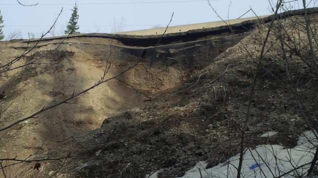
Photo courtesy City of Prince George
Prince George, B.C. – The City of Prince George is taking measures to ensure the safe flow of traffic along one its busier industrial roads.
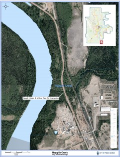
It’s due to soil erosion, and the measures will affect traffic on Willow Cale Road at the Haggith Creek crossing, located about 1.6 km south of the Penn Road/Milwaukee Way/Willow Cale Road intersection.
Engineering and public works general manager Dave Dyer says the problem was first discovered yesterday.
“It just came to our attention we have a slope on the west side of the road,” he says.
“There is undermining under the pavement and it’s started to creep under the pavement. So we’ve noticed as trucks are going over, there’s an unravelling of the slope. This is concerning that the loading of the vehicles and the speed of the vehicles are causing it to continue to deteriorate.”
As a result, Dyer says the City has reduced speeds to 30 km per hour and is installing delineators to move traffic from the west edge of the pavement.
On Monday, he says the City is planning to move a section of the concrete barriers to restrict the road to single lane traffic.
Dyer says crews will be monitoring the slopes raveling daily to determine if these measures will work to stop any further deterioration. If not, he says it may be necessary to close the road.
As for why this has happened, he’s not exactly sure.
“Maybe there’s some sort of freeze/thaw action going on that somehow with the truck traffic has started to make it worse.”
Nevertheless, Dyer says the City is currently in the design stage of a project to complete reconstruction of the culvert crossing at this location.
He says the $2 million project is part of the City’s capital plan this year.


Comments
Mr Dyer says they were just made aware of the problem yesterday. The folks working in the area have been talking about the problem for a long time. The concrete barriers have moved closer and closer to already making it a damn near single lane road. Who has been moving the barriers if not the City?
It is even worse than that. Assuming the quote is correct he stated: ““It just came to our attention we have a slope on the west side of the road”.
The City has had a GIS based mapping system of over a decade. It shows topographical information. The system should be programmed to show vulnerable locations of various types, including slopes adjacent to roads as well as soil types, etc.
That would generate, in addition to observations made by field staff over time and annotated on a map layer, which locations which need to be monitored on a frequent basis, especially during extreme weather events, seasonal traffic increases, etc.
Why would it just have come to the attention of the City there was a slope there?
He also said they were in the design stage of a project to complete reconstruction of the culvert crossing at this location.
They must be reconstructing the culvert for some reason. In any event its hard to believe that the road could get to this condition without the city being aware of it.
If they weren’t aware they should have been, and if they were aware they should have done something about it.
This has been a problem spot for years. The public knows about it why not the city?
Not my job.
One of the biggest salmon spawning creeks in the region. Always amazing to see with all the crap in the creek from the mill and people that throw their trash out there, and it being such a small creek, but its right full of salmon in the summer months.
Comments for this article are closed.