Images from Peace Region Flooding
Thursday, June 16, 2016 @ 5:18 PM
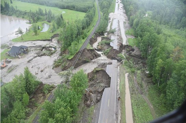
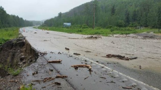
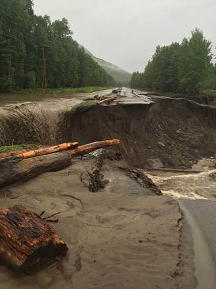
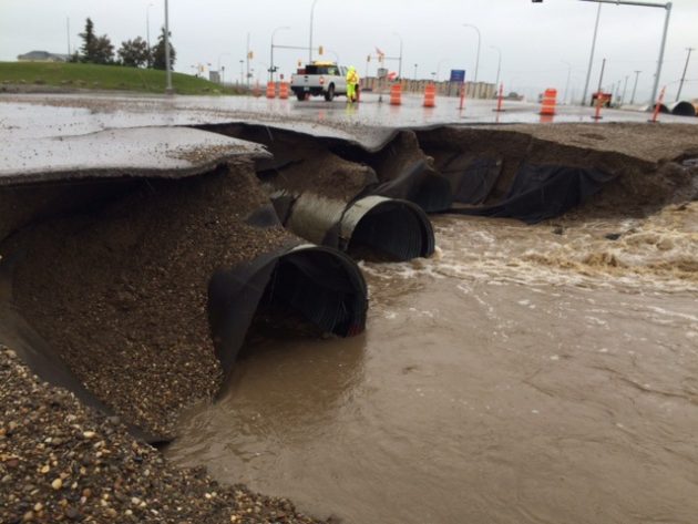
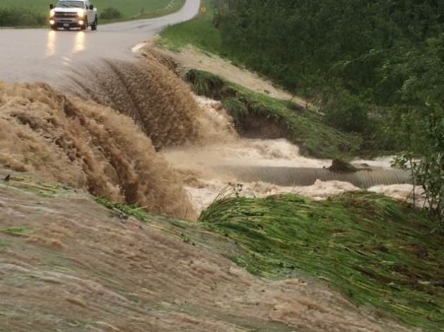
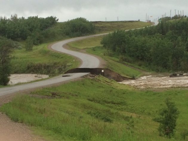
Prince George, B.C.- The Ministry of Transportation is assessing the damage to highways and other roads throughout the Peace Region in the wake of serious flooding. The Ministry has provided a number of images from the region, and we post them here for you to get an understanding of the devastation:
Below :Highway 97 15 km west of Chetwynd at Stone Creek
Below Highway 97 at Commotion Creek west of Chetwynd:
Below: Highway2 and 8th street in Dawson Creek:
Below:Mason Semple Road near Highway 97
and Rolla Road at Snakepit:

Comments
Wow, that’s amazing. Thanks for the great pictures.
Wow! Those are some very describing pictures. Mother Nature is a powerful thing!
This should not be happening for highways and railways which are designed for 100 year events.
How many other places along our highways in the interior of the province need such assessments and upgrades.
Some of this also has to do with climate change. How it is caused, really does not matter for this purpose. The fact is, one has to be ready for weather which is abnormal, in other words, 100 year events and even 200 year events. Let the specialist figure it out.
The question is, how much is this highway/railway closure costing, both closure as well as repairing. We never get any information about this. Why not? That would seem to be important. They finally spent hundreds of million dollars to fix all the mistakes of the original Squamish Highway to accommodate the amount of rainwater which comes down from the mountains.
If it was not for the expansion of Vancouver suburbia to Squamish, Whistler and Pemberton.
In the end a population of 30,000 at one end of the Hart to 90,000+ thousand to the south with close to 10,000 in between does not seem to matter in the eyes of Victoria, even though we are providing the spoils from forestry, mining of ore, oil and gas as well as hydro developments which feed the south with electricity.
This is what happens when you cheap out . Take out bridges and replace them with inadequate culverts . Dawson did that with 18 of them . Looks like highways did the same thing . Risk management is great , till it isn’t .
Are these the same or similar areas that experienced this a few years ago?
Yes it is and the repairs done to these areas looks to have been done by a bunch of wanna be road repair crews.
Looking at the pictures of damage west of Chetwynd none of them come from places damaged in 2011.
From huge fires to this…. hell of a start to the summer
Interesting how our current government is spending more than a billion dollars on twinning the highway from PG south via the Cariboo Connector, yet it is obvious many of the single lane highways north and to the east of PG need upgrading.
Misplaced priorities perhaps?
www .therockymountaingoat.com/2012/06/highway-16-flooding-updat/
Why does every weather event or fire have to be attributed to climate change? There were just as many weather events 30 years ago, it is only because of social media and technology that everything is reported so quickly and with so much coverage. Years ago you may have heard about it on the radio or tv or the next day when the newspaper came out.
Peter North asks the question; Why does every weather event or fire have to be attributed to climate change? Good question, but of course you won’t like the science based answer.
Scientists have linked increased “severe weather events” with climate change. “Powerful rain and snow storms—and, ironically, intense drought periods—are a well-known consequence of a warmer planet.”
If you are genuinely interested in what science has to say about this subject, go to the following link and educate yourself on the scientific facts.
www .ucsusa.org/global_warming/science_and_impacts/impacts/global-warming-rain-snow-tornadoes.html#.V2RgxPkrI2w
Comments for this article are closed.