Google Mapping in Cottonwood Island Park
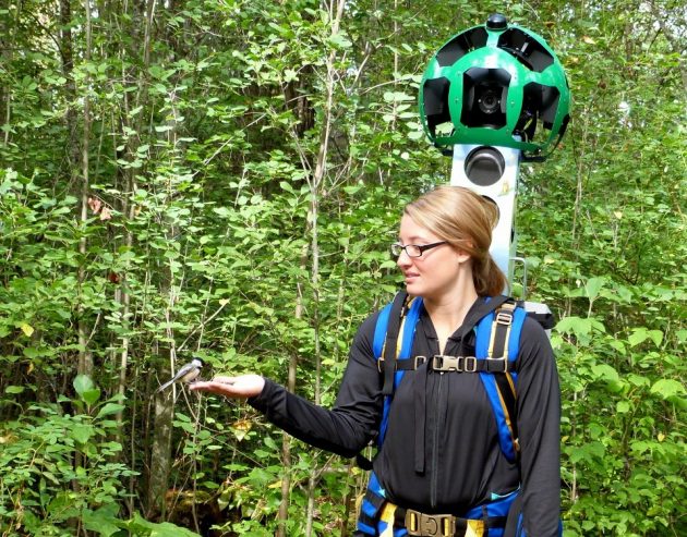
Tasha Peterson has a bird in the hand….photo 250News
Prince George, B.C.- The Google Street View Trekker continues its work in Northern B.C. with a walk through Cottonwood Island Park.
Destination British Columbia and the Northern BC Tourism Association joined forces with Google to bring the trekker here to capture the region’s natural beauty for Google Maps.
Yesterday, a team of Google Street Trekkers was discovered in Cottonwood Island Park by a 250News photographer, who taught google trekker Tasha Peterson how to entice a chickadee to eat right out of your hand.
The odd looking backpack Tasha is carrying can collect 360 panoramic images. There are 15 cameras atop the back pack, taking photos every couple of seconds .
This project is the largest “trekker” mapping project ever undertaken by Google Maps and a Provincial Tourism agency. It will cover 1,500 kms of areas not accessible by vehicles and wraps up at the end of this month.
With google maps used by a billion people every month, having the street view of what Super Natural B.C. has to offer can be a very positive marketing tool for Northern B.C. Tourism.
All of the images are expected to be uploaded to Google Maps for pubic viewing next year.


Comments
A great project.
Tell us how to entice chickadees to visit.
mnn.com/earth-matters/animals/stories/how-to-get-birds-to-eat-out-of-your-hand
Comments for this article are closed.