Clear Full Forecast

Wilkins Park Closed

By 250 News

Tuesday, June 26, 2007 03:58 AM

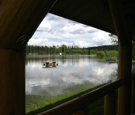
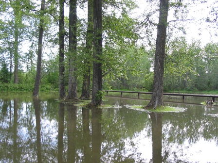
The view from the covered shelter at Wilkins Park

Wilkins Park, the regional park in Miworth, has been closed due to flooding from the Nechako River.

While residents in Vanderhoof have spent the past several weeks preparing for the the record high river flow levels with dikes and sandbags, this natural park on the outskirts of Prince George has been left to fend for itself.

The vehicle gate into the park is locked, with signs indicating it’s been temporarily closed due to flooding, but many residents have been venturing down on bikes, quads, or just on foot to see for themselves how far in-land the river has made it this year.

The sign in the background of the picture above is where the grassy bank normally ends and the beach leading out to the river begins. 

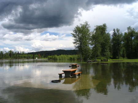
A number of benches on that bank are covered in water above the seat.

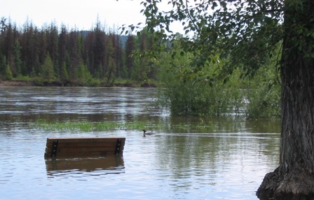
With, as this picture shot by Miworth resident Nancy Lowrie shows, just a lone merganser daring to venture near it.

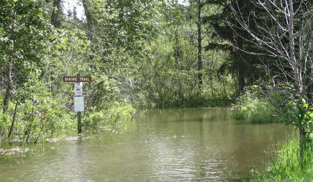
The loop road into the picnic area is also experiencing flooding on the entrance side, as shown in the photo below...

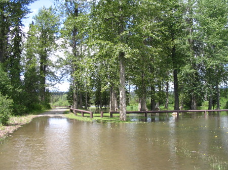
And behind the posts, what is normally the start of the lawn leading into the park is underwater at this point.

(photo at left courtesy of Nancy Lowrie)

Many of the trails through the park have been left impassable...

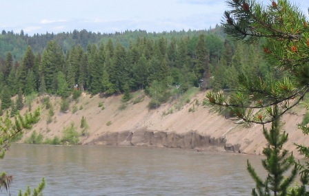
Of even greater concern to a number of residents living along the river’s edge in the community is a massive chunk of the bank that has just recently been washed away by the continued high water levels. (shown in picture below)


Previous Story - Next Story


Return to Home
NetBistro

Comments

I noticed that the river is up around three feet out Miworth, but it has actually dropped about 4 feet near the CN rail yard in town. I think if it gets warm in the next month and the Fraser levels start to come back up causing the Nechako to back up again, then we could have trouble in town, but it looks like it's all dependent on how high the Fraser flows for major flooding in PG.
One year when my youngest was still in infant carseat we were able to stand in the sand of the river bed. Mother nature sure was beautiful back then....we all sure make her angry.
The lots along the outside corners of the Nechako are about 300 feet deep. Anyone who has a lot like that and they see very little, if any vegetation or vegetation that is younger than say 30 or so years, should assume that their lot, under normal cirucmstances, would recede an average of one and maybe even 2 feet a year. So, 50 years later, count on living on not much more than a 100 to 200 foot deep lot. - 100 years, 200 to 100 foot lot.

If you build, build accrodingly.

Rip rap at the base will help the situation if done properly, if not, it will be sitting there like an island eventually with washouts from behind the rip rap.

Probably one of the best ways to offest the effect of water causing erosion in the outside corners is to build weirs at an agle from the shore out into the water a few feet and build them high enough so that high water will not wash over them, and rebuild any washouts to the back of them which may have occurred. If done properly, it will actually build up sand carried from upstream and increase the shoreline.

That should have been required of the developer when the area was subdivided some 40 years ago. The Regional District should have required base protection as part of the development cost no less than a developer or land owners having to provide retaining walls if properties are otherwise in jeopardy.