


Near Record Temps and Thundershowers
By 250 News
 The dogged days of summer will continue as the heat wave rolling across the region will carry into next week.
Environment Canada has issued a severe thunderstorm watch for both Smithers and Terrace in the northwest and the forecast for the Prince George region is calling for the risk of thundershowers both later today and throughout tomorrow, and the hot temperatures will persist.
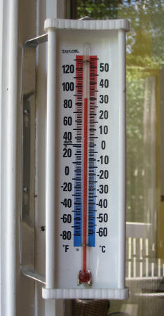
For Prince George, the mercury is expected to climb to 35-degrees Celsius today. Yesterday’s maximum temperature was 33.4-degrees, just one-degree shy of the record 34.4 set back in 1961. The normal temperature for the region at this time of year is 23.
And Environment Canada’s long range, five-day forecast does not show the sweltering heat letting up with highs of 32 tomorrow, 27 on Sunday, 28 on Monday and then back up to 32-degrees by Tuesday.
Around the region, the situation is much the same.
Smithers’ maximum temperature of 34.6-degrees yesterday smashed the record set in 1961 of 30.6. Terrace’s hot high of 31.5 yesterday was also slightly above the record 31.1, also set in 1961.
Prince Rupert also shattered a record high of 18.1 set in 2003 with yesterday’s high of 25.4. Normals for the region are 16-degrees at this time of year.
To the north, Fort St. John was near its 1961 record of 31.7, with a max yesterday of 31.3-degrees.
Quesnel was the regional hot spot yesterday, topping out at 35.5-degrees yesterday afternoon. The high did not beat the 1961 record of 36.7. Williams Lake hit 32.7, also below the ’61 record of 33.9.
It appears 2007 could be on track to rival the summer of ’61.
Previous Story - Next Story
Return to Home