Quest Project Takes Flight...Again
By 250 News
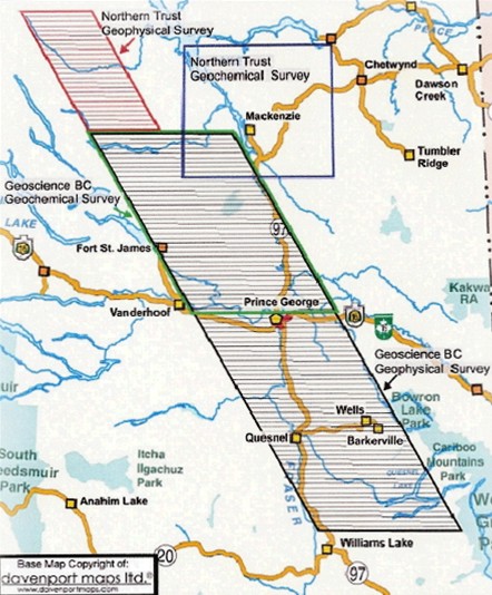
Map shows flight lines at 4 km spacing, gravity survey flights will be at 2km intervals.
Prince George, B.C. – Don’t be surprised to see a plane flying at a low level over the region during the next few weeks. This is the second part of the Quest project which is gathering data on possible mineral deposits below the glacial till that covers the region.
Throughout the summer, the first part of the project had a helicopter criss-crossing the region from Williams Lake to Mckenzie, mapping the electromagnetic signatures through the region.
The second part of the research is an airborne gravity survey. The plane will cover 40 thousand square kilometres. The airborne gravity survey will have a 2 km spacing meaning there will be 170 flights looking for minute changes that will indicate a higher density of rock, possibly because of mineral deposits.
The third part of the study has already been completed, it involved gathering lake, stream, and till geo-chemical samples being taken throughout the region. ``Those samples are now off to the lab for analysis” says Lyn Anglin, the President and CEO of GeoScience B.C. “But it will take some time before the reports are complete.” She says it’s hoped the reports will be ready by next April.
As for the electromagnetic survey, Anglin says that data is complete “It has produced some interesting features, but we haven’t completed the analysis of all the information.”
The information is expected to be released in the new year. There are hopes the information will spark interest for the development of new mines in a region that has been devastated by the mountain pine beetle.
Previous Story - Next Story
Return to Home