


Nechako Up One Foot
By 250 News
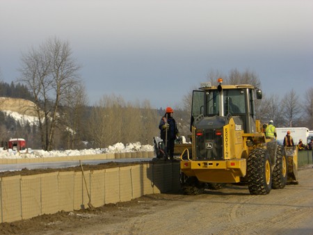
Crews install gabion dikes on river road (click on photo to see crews working on compressing dirt into the dikes)
Prince George, B.C. - The Nechako river has risen again overnight. Twice overnight, observers noted significant movement in the ice jam, and at those times, the water levels rose, then fell about two feet.
Today, the level of the river is one foot higher than it was yesterday, and the ice jam has doubled from it’s 2 km length of earlier in the week to 4 km.
Emergency officials will be meeting with the Strata Council of the Delhaven condominium complex to talk about possibly installing some gabion dikes to even up the property profile. Even with the dikes though, residents will be expected to see ground water seepage into their basements.
The River breached the first line of gabion dikes behind TDB Forestry, which is east of the Brink Forest Products operation on River Road. However, the breach did not create any major new impacts. There is a second line of dikes along that area.
Today, crews will start building an earth berm on the west side of the John Hart Bridge, extending it past the Pacific Western Brewing Plant, and Cedars Christian School.
The costs to the City for dealing with the flood are now pegged at $738 thousand dollars, and those funds will be reimbursed by the Province.
Previous Story - Next Story
Return to Home