


The Icejam: In Pictures
By 250 News
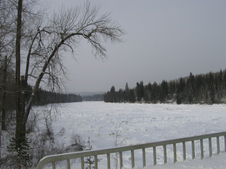
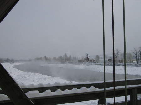
The Nechako icejam as it stretches west from the Foothills Bridge
Prince George, B.C.- As of late yesterday afternoon, the Nechako River icejam was estimated to span approximately 27-kilometres -- from its confluence with the Fraser to the Bergman Road-area in Miworth.
For those not able to get a first-hand look, Opinion250 braved yesterday’s bitter temperatures to capture some shots of the massive build-up of frazil ice that stretches as far as the eye can see.
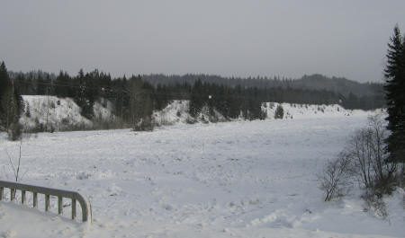
While the picture above is looking west from the Foothills Bridge towards Miworth, the picture below is looking east towards the city...
Local emergency officials say it was the combined efforts of the Amphibex and Mother Nature that resulted in an almost seven-kilometre opening in the ice, from fishtrap island to the Nechako’s confluence with the Fraser.
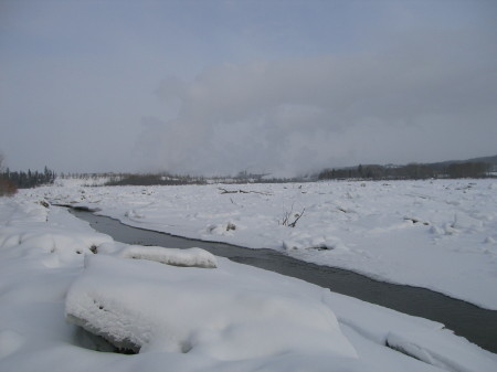
That opening, with its fast-flowing water, is visible looking west from the Cameron Street Bridge.
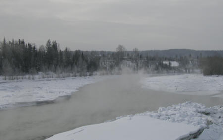
The City’s Liaison Officer, Kevin Brown, says what appears to be steam rising from the open channel is actually condensation...the water is about one-degree Celsius and begins to condense when it hits the much colder air above.
Below is a shot of the river at the Cameron Street Bridge...
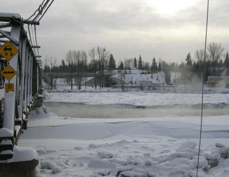
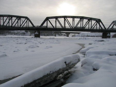
And, then, looking east towards Cottonwood Island Park and the Nechako’s confluence with the Fraser...
EOC Operations Manager, Marco Fornari says it was this area of the river that proved to be very dangerous for the Amphibex. He says the river narrows and the current is very strong. A powerboat was brought in to try and push the Amphibex up through the current and, when that didn’t work, the Amphibex was trucked to a spot just west of the Cameron Street Bridge, where it re-entered the river to continue chipping away at the ice.
Finally, the pictures below show the pile-up of frazil ice that has accumulated in the Fraser River since it froze over on Sunday. The picture on the left is looking north towards the confluence, the picture on the right is looking south towards the CN Rail bridge.
Previous Story - Next Story
Return to Home
Sure wish I could have seen the amphidex in action though! How do they get it in and out of the water? winch? or does it walk?