Erosion Control Work Set to Start at Fraser River Bench Lands

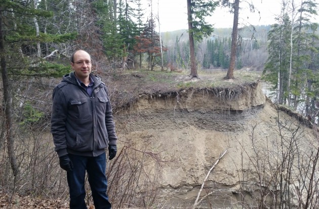
Fraser River Bench Outfall Remediation Project manager Chris Vliegenthart – photos 250News
Prince George, B.C. – Work will start next Monday on the Fraser River Bench Lands Outfall Remediation Project.
The City’s contractor, LNB Construction Ltd, will construct a storm water management system to prevent ongoing soil erosion and property damage in the area.
City project manager ChrisVliegenthart says they’ve been eyeing the project since 2012.
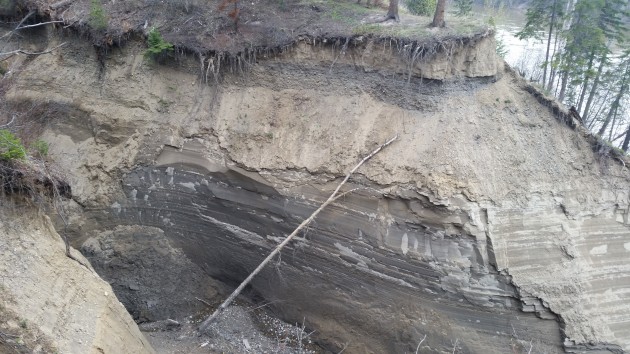
“At some point the natural drainage channel that was here got to a critical point where the water got to the highly rootable soils and starting cutting into the ground and there’s nothing holding it back once it got past the surface materials and the root structures.
“And since then it’s been expanding in length and taking about 1,000 cubic metres of soil into the river every year.”
He says the area receives a large portion of the storm water collected from College Heights and notes the new system needs to be implemented to ensure that it is safe for current and future developments.
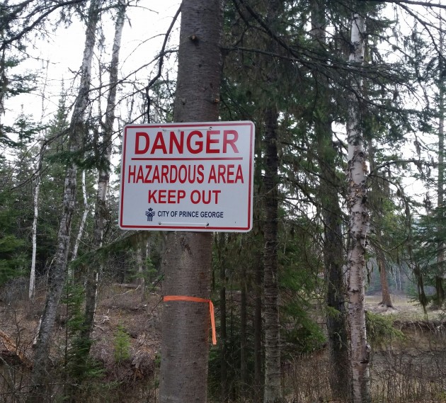
“In the past few years, the flow of storm water along the natural drainage channel has carved a near vertical ravine down to the Fraser River. Due to safety concerns, we encourage the public to avoid the area until construction operations are completed.”
Once the area has been cleared, Vliegenthart tentatively expects construction to start next month before wrapping up this fall.
The City will host a public information session tonight for the residents of Creekside Way and Stillwater Crescent.
The project is funded by the “New Building Canada Fund – Small Communities Fund” program, with a budget of $1.41 million.
Announced last summer, both the federal and provincial governments will contribute $470,000 while the City of Prince George will be responsible for all the remaining costs of the project.


Comments
Thank you PM Trudeau . This is real change !
Ataloss, real change?
“New Building Canada Fund – Small Communities Fund
Canada and British Columbia launched the New Building Canada Fund – Small Communities Fund (NBCF-SCF) Program in October 2014. The NBCF-SCF’s first round of applications resulted in $128 million allocated to 55 communities throughout British Columbia. The 2nd intake for applications has officially opened and will be closing on April 28, 2016.”
Ataloss, this real change was launched under the former Federal Government! Why are you thanking Justin for a program that I don’t think that he had anything whatsoever to do with?
Because Trudeau cut the check . Now be grateful !
Ataloss, be grateful? You can’t be serious!
As noted above in my earlier comment (in case you didn’t read it) the program was introduced in October 2014. The first round of applications resulted in $128 Million allocated to 55 communities throughout BC!
The 2nd intake for applications has officially opened and will be closing on April 28, 2016.
The story above states that the project is funded by the “New Building Canada Fund – Small Communities Fund” program, with a budget of $1.41 million.
Announced last summer, both the federal and provincial governments will contribute $470,000 while the City of Prince George will be responsible for all the remaining costs of the project.
This program was launched under the previous Federal Government and the Fraser River Bench Lands Outfall Remediation Project was announced last summer BEFORE the Federal election!
So, why are you thanking Justin?
The river trail used to cut right across the present washout near those two trees in the bottom picture. The washout first formed about fifteen years ago during a rapid spring melt. A huge pond formed then broke through to the river. The washout has been getting bigger ever since.
Should be the two trees top picture, better view than the bottom picture.
Are we fighting mother nature or some poorly located storm water pitfalls?
Fighting mother nature is an expensive and never ending battle. Best to leave her alone and plan accordingly.
“Best to leave her alone and plan accordingly.” Huh your statement almost equals a double negative.
This mitigation work is a result of poor planning now being corrected. There is a new subdivision right beside that hazardous washout, that is why the mitigation work. This washout has high vertical crumbling sides and needs to be made safe because of its close proximity to the subdivision.
hey even beavers mitigate for mother.
“our statement almost equals a double negative” It is either a double negative or it is not. There is no gradation.
Best to leave her alone means figure out how much the bank will naturally erode over a 100, 200, 300 year window or more. Very similar to planning for estimated 100, 200 year flood plains.
Based on that, lay out subdivision lots and roads accordingly. A common method used is to locate parkland adjacent to the river and do not put fixed, improved walkways close to the escarpment.
Cottonwood Island is a good example of what not to do with its trail systems that are close to the waterfront. So is Paddlewheel Park with its benches and picnic shelter as well as adjacent riverfront housing which are all under water when the river floods, and the river is flooding quite frequently.
By the time CH properties adjacent to the river were planned, the City should have known the dangers of building close to the river. Natural runoffs should have been gathered in swales leading to ponds removed from the river front and drained into catch basins and led away through a piped storm water system to locations where it can be drained safely into the river.
The Hudson Bay Slough is one such example where nature has devised a drainage system we need to learn to emulate.
On a world scale, those who deal with annual flooding of the Mississippi, the Rhine and other large rivers are starting to design river adjacent development to accommodate the natural system rather than fighting it.
—————————————-
Why do they have to correct this now?
Why was it not done that way in the first place?
The knowledge of river hydrology has not changed much since then.
Does anyone know what they will now do to stop the erosion? Who is going to guarantee that it will work? Will this guarantee be any better than that of geological engineers a the time the original subdivision was built?
We really know zip about this as far as I can tell.
Pitfalls?? Lol
Pitfalls…. nice Freudian slip by correct :-)
it did it a second time … tablets can be useless ….
That should read storm water “outfalls”
and instead of just “correct” on the second one it should read “autocorrect” … bad karma today…. :-(
So gopg2015 you are okay with leaving a very dangerous situation as is right next to a subdivision. This is a very different situation than paddlewheel or cottonwood island park. Though Cottonwood island park could use riprap but that might disturb the fishies.
That is what they are doing now mitigating and putting in drainage.
This is about subsidizing a developer for a development that never should have been approved in the first place. Its all about land arbitrage for developers using land use policies as a way to make profits at the greater public’s expense. Its standard practice for PG developers in the last 30-years.
Comments for this article are closed.