


A Day Of Watching Water Levels
The rising level of the Nechako has prompted the closure of Cottonwood Island Park
The Regional District of Fraser-Fort George continues to monitor river and tributary levels throughout the district, but says, so far, the situation has changed little from yesterday.
The District's Manager of Projects and Communications, Finlay Sinclair, says, "Nothing's changed for now anyway - we're all good."
 Sinclair says district staff huddled this morning, getting updates from the provincial hydrologist. He says field monitoring will continue throughout the day and some sandbags will be dropped off in Willow River as a precautionary measure.
"I do know one dwelling's been impacted (in that small community to the east), but, from what I understand, it's more a sump pump issue and not being able to remove some water that's showing up versus the river overflowing."
As for the weather's impact, Sinclair says, "There's a bunch of water left to come and whether it's through rain or warm weather, I think we're going to start seeing it, so we're just trying to be cautious and prepared."
But, he says, "So far, so good - we haven't seen anything to suggest that we have a problem at this point."
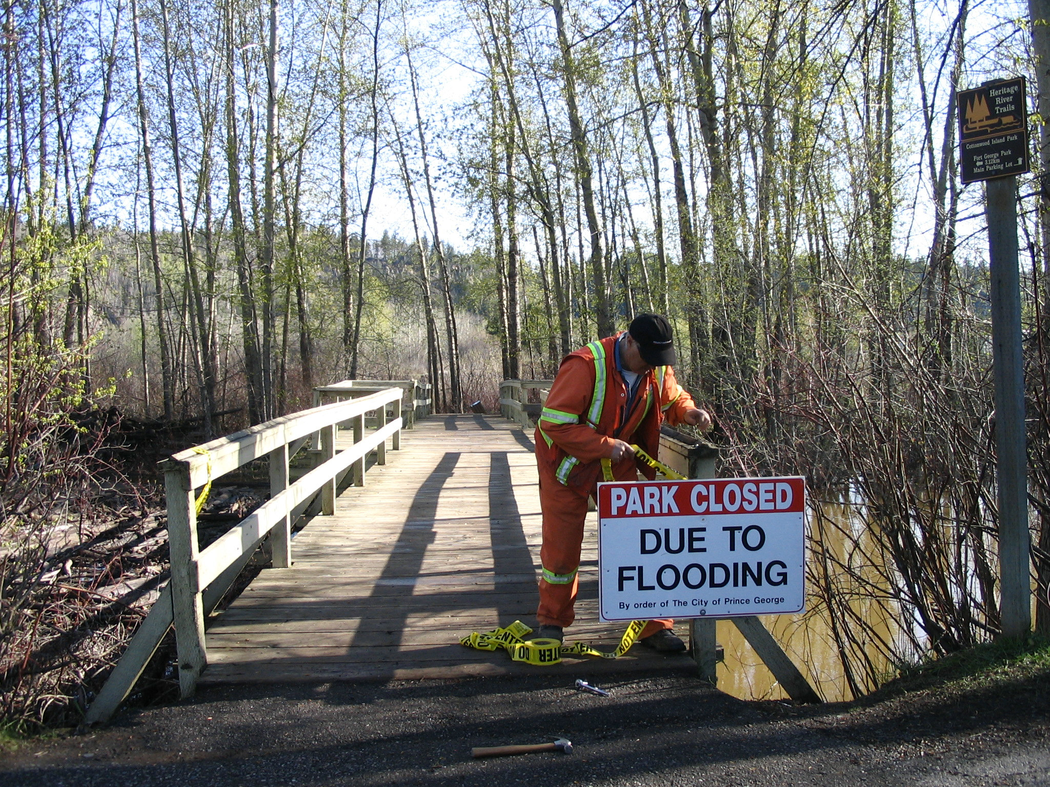 Cottonwood Island Park was closed to pedestrians this morning, after the Nechako River rose overnight and flooded some of the walking trails along the river's edge.
According to Environment Canada's monitoring station, the current primary water level of the Nechako in Vanderhoof is now 4.264 metres (there is no local monitor).
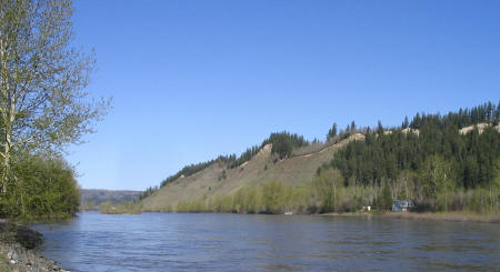
The Fraser River's level has climbed from 7.5-metres last night and was reading 8.16-metres in South Fort George as of 8am this morning.
The City's Emergency Program spokesperson, Fire Chief Jeff Rowland, says the river is expected to peak at somewhere around 8.6-metres tomorrow.
Rowland says monitoring continues and the City issued a precautionary warning yesterday. The flood level is 9.2-metres.
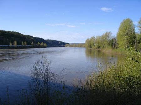
Picture below shows the Fraser River this morning looking south from the Yellowhead Bridge
Previous Story - Next Story
Return to Home
http://flickr.com/photos/23881196@N00/tags/floodpreparationsnewwestminsterbc
Does anyone know how the 9.2 metre flood level relates to the 200 year flood plane. Iis it lower? If so, by how much?
9.2 metres has no meaning to me. Where is the 0 metre mark in relation to sea level? The rest I can figure out myself.